
Thank you for supporting this site ❤️
Make a donation
Make a donation
13190 topographic map
Click on the map to display elevation.
Thank you for supporting this site ❤️
Make a donation
Make a donation
About this map
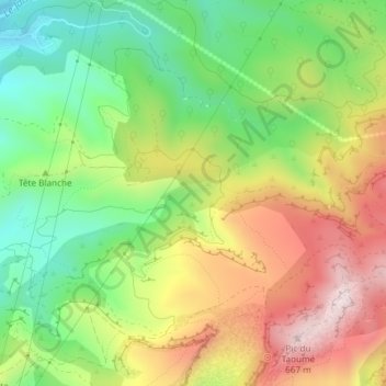
Name: 13190 topographic map, elevation, terrain.
Average elevation: 403 m
Minimum elevation: 192 m
Maximum elevation: 662 m
Thank you for supporting this site ❤️
Make a donation
Make a donation
Other topographic maps
Click on a map to view its topography, its elevation and its terrain.
Les Grands Louis
France > Provence-Alpes-Côte d'Azur > Bouches-du-Rhône > Allauch
Average elevation: 275 m