
Redbank topographic map
Interactive map
Click on the map to display elevation.
About this map
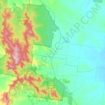
Name: Redbank topographic map, elevation, terrain.
Location: Redbank, Shire of Pyrenees, Victoria, 3478, Australia (-36.97331 143.21881 -36.83787 143.41218)
Average elevation: 318 m
Minimum elevation: 213 m
Maximum elevation: 613 m
Other topographic maps
Click on a map to view its topography, its elevation and its terrain.