
Thank you for supporting this site ❤️
Make a donation
Make a donation
Qingtian County topographic map
Click on the map to display elevation.
Thank you for supporting this site ❤️
Make a donation
Make a donation
About this map
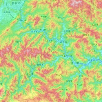
Name: Qingtian County topographic map, elevation, terrain.
Location: Qingtian County, Lishui, Zhejiang, 323900, China (27.92962 119.79974 28.48383 120.43196)
Average elevation: 474 m
Minimum elevation: 1 m
Maximum elevation: 1,467 m
Thank you for supporting this site ❤️
Make a donation
Make a donation
Other topographic maps
Click on a map to view its topography, its elevation and its terrain.