
Foughala topographic map
Interactive map
Click on the map to display elevation.
About this map
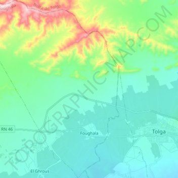
Name: Foughala topographic map, elevation, terrain.
Location: Foughala, Daïra Foughala, Biskra, Algérie (34.70062 5.23083 34.82037 5.35029)
Average elevation: 240 m
Minimum elevation: 125 m
Maximum elevation: 665 m
Other topographic maps
Click on a map to view its topography, its elevation and its terrain.
Oued El Ouzzane
Algérie > Biskra > Daïra Foughala > El Ghrous
Oued El Ouzzane, El Ghrous, Daïra Foughala, Biskra, Algérie
Average elevation: 180 m