
Thank you for supporting this site ❤️
Make a donation
Make a donation
Lind topographic map
Click on the map to display elevation.
Thank you for supporting this site ❤️
Make a donation
Make a donation
About this map
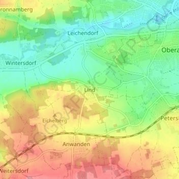
Name: Lind topographic map, elevation, terrain.
Location: Lind, Zirndorf, Landkreis Fürth, Bayern, 90513, Deutschland (49.40136 10.91655 49.44136 10.95655)
Average elevation: 334 m
Minimum elevation: 295 m
Maximum elevation: 384 m
Thank you for supporting this site ❤️
Make a donation
Make a donation
Other topographic maps
Click on a map to view its topography, its elevation and its terrain.