
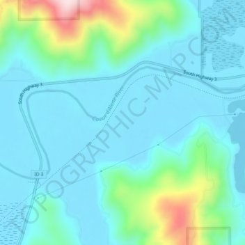
Coeur d'Alene River topographic map
Interactive map
Click on the map to display elevation.
About this map
Name: Coeur d'Alene River topographic map, elevation, terrain.
Average elevation: 707 m
Minimum elevation: 643 m
Maximum elevation: 999 m
Other topographic maps
Click on a map to view its topography, its elevation and its terrain.
Robie Creek
United States of America > Idaho
Robie Creek, Boise County, Idaho, United States of America
Average elevation: 1,264 m
Basalt
United States of America > Idaho > Basalt
Basalt, Bingham County, Idaho, 83218, United States of America
Average elevation: 1,398 m
Horse Ranch Mountain
United States of America > Idaho
Horse Ranch Mountain, Elmore County, Idaho, United States of America
Average elevation: 1,843 m
Nordman
United States of America > Idaho
Nordman, Bonner County, Idaho, 83848, United States of America
Average elevation: 831 m
Vernon Lake
United States of America > Idaho
Vernon Lake, Trail 482, Boise County, Idaho, United States of America
Average elevation: 2,686 m
Featherville
United States of America > Idaho > Featherville
Featherville, Elmore County, Idaho, United States of America
Average elevation: 1,513 m
Kendrick
United States of America > Idaho > Kendrick
Kendrick, Latah County, Idaho, 83537, United States of America
Average elevation: 559 m
Blackmare Lake
United States of America > Idaho
Blackmare Lake, Needles Route Pack Trail, Valley County, Idaho, United States of America
Average elevation: 2,298 m