
Ma Wan Tsuen topographic map
Interactive map
Click on the map to display elevation.
About this map
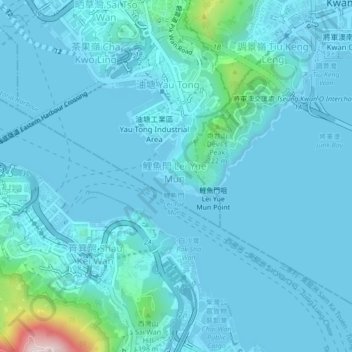
Name: Ma Wan Tsuen topographic map, elevation, terrain.
Location: Ma Wan Tsuen, Kwun Tong District, Kowloon, Hong Kong, China (22.26808 114.21883 22.30808 114.25883)
Average elevation: 43 m
Minimum elevation: -3 m
Maximum elevation: 497 m
Other topographic maps
Click on a map to view its topography, its elevation and its terrain.
Ho Man Tin East Service Reservoir Playground
Ho Man Tin East Service Reservoir Playground, Lo Lung Hang, Ho Man Tin, Kowloon City District, Kowloon, Hong Kong, China
Average elevation: 22 m