
Tishomingo topographic map
Interactive map
Click on the map to display elevation.
About this map
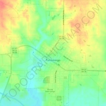
Name: Tishomingo topographic map, elevation, terrain.
Location: Tishomingo, Johnston County, Oklahoma, 73460, United States (34.21594 -96.70447 34.25954 -96.65378)
Average elevation: 214 m
Minimum elevation: 188 m
Maximum elevation: 242 m