
Sungai Baung topographic map
Interactive map
Click on the map to display elevation.
About this map
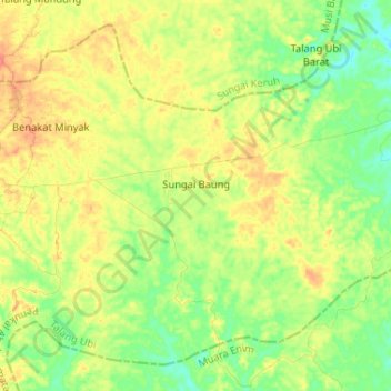
Name: Sungai Baung topographic map, elevation, terrain.
Average elevation: 56 m
Minimum elevation: 31 m
Maximum elevation: 85 m
Other topographic maps
Click on a map to view its topography, its elevation and its terrain.
Pandan
Indonesia > South Sumatra > Penukal Abab Lematang Ilir > Pandan
Pandan, Tanah Abang, Penukal Abab Lematang Ilir, South Sumatra, Indonesia
Average elevation: 12 m