
Kampung Batu 11 1/2 topographic map
Interactive map
Click on the map to display elevation.
About this map
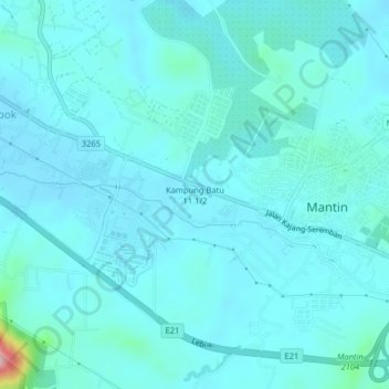
Name: Kampung Batu 11 1/2 topographic map, elevation, terrain.
Average elevation: 67 m
Minimum elevation: 43 m
Maximum elevation: 280 m
Other topographic maps
Click on a map to view its topography, its elevation and its terrain.
Kampung Setul
Malaysia > Negeri Sembilan > Mantin
Kampung Setul, Mantin, Seremban, Negeri Sembilan, 71700, Malaysia
Average elevation: 112 m