
Thank you for supporting this site ❤️
Make a donation
Make a donation
Le Bourg topographic map
Click on the map to display elevation.
Thank you for supporting this site ❤️
Make a donation
Make a donation
About this map
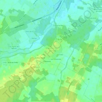
Name: Le Bourg topographic map, elevation, terrain.
Average elevation: 95 m
Minimum elevation: 87 m
Maximum elevation: 105 m
Thank you for supporting this site ❤️
Make a donation
Make a donation
Other topographic maps
Click on a map to view its topography, its elevation and its terrain.
Écluse de May
France > Centre-Val de Loire > Loiret > Chevillon-sur-Huillard > Le Bois du May
Average elevation: 92 m