
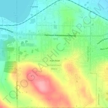
Jamestown West topographic map
Interactive map
Click on the map to display elevation.
About this map
Name: Jamestown West topographic map, elevation, terrain.
Average elevation: 441 m
Minimum elevation: 395 m
Maximum elevation: 508 m
Other topographic maps
Click on a map to view its topography, its elevation and its terrain.
Village of Falconer
United States > New York > Chautauqua County > Town of Ellicott
Village of Falconer, Town of Ellicott, Chautauqua County, New York, United States
Average elevation: 399 m
Village of Celoron
United States > New York > Chautauqua County > Town of Ellicott
Village of Celoron, Town of Ellicott, Chautauqua County, New York, 14720, United States
Average elevation: 410 m