
往洞镇 topographic map
Interactive map
Click on the map to display elevation.
About this map
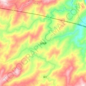
Name: 往洞镇 topographic map, elevation, terrain.
Location: 往洞镇, 从江县, 黔东南苗族侗族自治州, 贵州省, 中国 (25.90740 108.65800 25.98740 108.73800)
Average elevation: 707 m
Minimum elevation: 387 m
Maximum elevation: 1,012 m