
Make a donation
Bad Westernkotten topographic map
Click on the map to display elevation.
Make a donation
Bad Westernkotten
Wirtschaftlich spielte im 19. Jahrhundert die Salzindustrie weiterhin die wichtigste Rolle und erreichte mit einer jährlichen Produktion von etwa 35.000 Zentnern um 1850 ihren Höhepunkt.
Make a donation
About this map
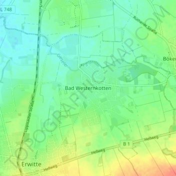
Name: Bad Westernkotten topographic map, elevation, terrain.
Average elevation: 94 m
Minimum elevation: 79 m
Maximum elevation: 124 m
Make a donation
Other topographic maps
Click on a map to view its topography, its elevation and its terrain.
Eikeloh
Deutschland > Nordrhein-Westfalen > Kreis Soest > Erwitte
Das Dorf Eikeloh, mit zurzeit 504 Einwohnern, liegt etwa drei Kilometer östlich von Erwitte am nördlichen Fuß des Haarstranges. Der niedrigste Punkt von Eikeloh (97,5 m ü. NN) liegt an der Grenze zu Bökenförde, zum Süden hin steigt der Ort bis auf 167,5 m ü. NN an. Die Kirche liegt auf einer Höhe von…
Average elevation: 122 m
Schallern
Deutschland > Nordrhein-Westfalen > Kreis Soest > Erwitte
Schallern liegt unmittelbar etwa 10 km westlich von Erwitte, 10 km östlich von Soest und 35 km westlich von Paderborn sowie 45 km östlich von Dortmund. Das Dorf liegt zudem auf direkter Höhe des alten Hellwegs bzw. der heutigen Bundesstraße 1.
Average elevation: 101 m
Make a donation