
Kalzhofen topographic map
Interactive map
Click on the map to display elevation.
About this map
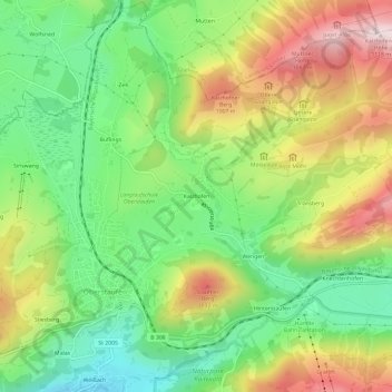
Name: Kalzhofen topographic map, elevation, terrain.
Average elevation: 851 m
Minimum elevation: 661 m
Maximum elevation: 1,114 m
Other topographic maps
Click on a map to view its topography, its elevation and its terrain.
Saneberg
Deutschland > Bayern > Landkreis Oberallgäu > Oberstaufen
Saneberg, Oberstaufen, Landkreis Oberallgäu, Bayern, 87534, Deutschland
Average elevation: 829 m