
南甸镇 topographic map
Interactive map
Click on the map to display elevation.
About this map
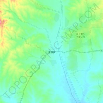
Name: 南甸镇 topographic map, elevation, terrain.
Location: 南甸镇, 石家庄市, 河北省, 中国 (38.34577 114.07744 38.42577 114.15744)
Average elevation: 171 m
Minimum elevation: 132 m
Maximum elevation: 295 m
Other topographic maps
Click on a map to view its topography, its elevation and its terrain.