
蟠桃峪村 topographic map
Interactive map
Click on the map to display elevation.
About this map
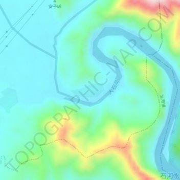
Name: 蟠桃峪村 topographic map, elevation, terrain.
Location: 蟠桃峪村, 石门寨镇, 海港区, 秦皇岛市, 河北省, 中国 (40.06914 119.65002 40.07126 119.65661)
Average elevation: 130 m
Minimum elevation: 44 m
Maximum elevation: 438 m
Other topographic maps
Click on a map to view its topography, its elevation and its terrain.