
Kendall topographic map
Interactive map
Click on the map to display elevation.
About this map
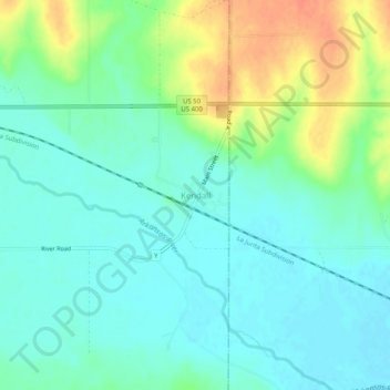
Name: Kendall topographic map, elevation, terrain.
Location: Kendall, Hamilton County, Kansas, 67857, United States (37.91474 -101.56600 37.95474 -101.52600)
Average elevation: 965 m
Minimum elevation: 950 m
Maximum elevation: 997 m
Other topographic maps
Click on a map to view its topography, its elevation and its terrain.
Syracuse
United States > Kansas > Hamilton County
Syracuse, Hamilton County, Kansas, 67878, United States
Average elevation: 992 m
Coolidge
United States > Kansas > Hamilton County
Coolidge, Hamilton County, Kansas, 67836, United States
Average elevation: 1,027 m