
Thank you for supporting this site ❤️
Make a donation
Make a donation
Tandil topographic map
Click on the map to display elevation.
Thank you for supporting this site ❤️
Make a donation
Make a donation
About this map
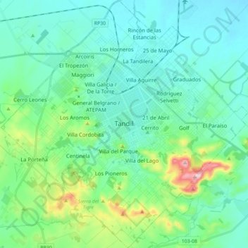
Name: Tandil topographic map, elevation, terrain.
Location: Tandil, Partido de Tandil, Buenos Aires, Argentina (-37.39785 -59.22210 -37.25939 -59.04832)
Average elevation: 224 m
Minimum elevation: 159 m
Maximum elevation: 499 m
Thank you for supporting this site ❤️
Make a donation
Make a donation
Other topographic maps
Click on a map to view its topography, its elevation and its terrain.