
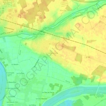
La Bretauche topographic map
Interactive map
Click on the map to display elevation.
About this map
Name: La Bretauche topographic map, elevation, terrain.
Average elevation: 106 m
Minimum elevation: 88 m
Maximum elevation: 120 m
Other topographic maps
Click on a map to view its topography, its elevation and its terrain.
Pont-Aux-Moines
France > Centre-Val de Loire > Loiret > Mardié
Pont-Aux-Moines, Mardié, Orléans, Loiret, Centre-Val de Loire, France métropolitaine, 45430, France
Average elevation: 108 m
La Perrière
France > Centre-Val de Loire > Loiret > Mardié
La Perrière, Mardié, Orléans, Loiret, Centre-Val de Loire, France métropolitaine, 45430, France
Average elevation: 109 m