Geolocate

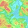
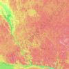
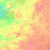
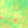
Manawan topographic map

Click on the map to display elevation.

About this map

Name: Manawan topographic map, elevation, terrain.

Location: Manawan, Lanaudière, Quebec, J0K 1M0, Canada (47.20141 -74.40766 47.24141 -74.36766)

Average elevation: 455 m

Minimum elevation: 413 m

Maximum elevation: 537 m

Other topographic maps

Click on a map to view its topography, its elevation and its terrain.

Notre-Dame-des-Bois

Canada > Quebec > Le Granit

Average elevation: 593 m

Quebec

Canada > Quebec > Urban agglomeration of Québec

Quebec City was built on the north bank of the Saint Lawrence River, where it narrows and meets the mouth of the Saint-Charles River. Old Quebec is located on top and at the foot of Cap-Diamant, which is on the eastern edge of a plateau called the promontory of Quebec (Quebec hill). Because of this topographic…

Average elevation: 117 m

Laval (administrative region)

Canada > Quebec

Average elevation: 42 m

Quebec

Canada > Quebec > Urban agglomeration of Québec

Quebec City was built on the north bank of the Saint Lawrence River, where it narrows and meets the mouth of the Saint-Charles River. Old Quebec is located on top and at the foot of Cap-Diamant, which is on the eastern edge of a plateau called the promontory of Quebec (Quebec hill). Because of this topographic…

Average elevation: 117 m

Lanaudière

Canada > Quebec

The region of Lanaudière is part of central Quebec and is located between the Saint Lawrence River and the Laurentian Mountains, between Mauricie and the Laurentides. Lanaudière attracts a good deal of interest from vacationers due to its unique character founded largely on the harmony between its culture…

Average elevation: 332 m

Rivière-Rouge

Canada > Quebec > Antoine-Labelle

Average elevation: 371 m

Côte-Nord

Canada > Quebec

Average elevation: 327 m

Wakefield

Canada > Quebec > Les Collines-de-l'Outaouais

Average elevation: 151 m

Montérégie

Canada > Quebec

Average elevation: 157 m

Témiscamingue

Canada > Quebec

Average elevation: 318 m

Lévis

Canada > Quebec

Average elevation: 96 m

Gaspé Peninsula

Canada > Quebec

Average elevation: 190 m

Le Rocher-Percé

Canada > Quebec

Average elevation: 147 m

Mont-Tremblant

Canada > Quebec > Les Laurentides

The city is dominated by Mont Tremblant with an altitude of 968m which is one of the highest peaks in southern Quebec.

Average elevation: 358 m

Sherbrooke

Canada > Quebec

Average elevation: 232 m

Rivière-à-Pierre

Canada > Quebec > Portneuf (MRC)

Average elevation: 346 m

Rivière de la Petite Nation

Canada > Quebec > Papineau

Average elevation: 274 m

Lac-Supérieur

Canada > Quebec > Les Laurentides

Average elevation: 458 m

Rivière Péribonka

Canada > Quebec

Average elevation: 487 m

Trois-Rivières

Canada > Quebec

Average elevation: 39 m

Forêt Montmorency

Canada > Quebec > La Côte-de-Beaupré > Lac-Jacques-Cartier

Located in the Laurentian Mountains, the Montmorency forest is drained by the Montmorency River and by one of its tributaries, the Black river. There are four lakes: Lac Piché, Bédard, Laflamme and Joncas. The altitude varies between 600 and 1,000 meters (3,300 ft) with an average of 750 meters. The…

Average elevation: 794 m

La Côte-de-Gaspé

Canada > Quebec

Average elevation: 148 m

La Haute-Gaspésie

Canada > Quebec

Average elevation: 247 m

La Haute-Côte-Nord

Canada > Quebec

Average elevation: 348 m

Abitibi-Témiscamingue

Canada > Quebec

Average elevation: 333 m

Chaudière-Appalaches

Canada > Quebec

Average elevation: 323 m

Mékinac

Canada > Quebec

Average elevation: 344 m

Gatineau

Canada > Quebec

Gatineau is located in southwestern Quebec, on the northern bank of the Gatineau River. It is situated at an elevation of around 50 m (164.042 ft) The Gatineau Hills are the foothills of the Laurentian Mountains and located in the region. It is also the location of the second largest urban park in the world.…

Average elevation: 127 m

Deux-Montagnes (MRC)

Canada > Quebec

Average elevation: 49 m

Sainte-Adèle

Canada > Quebec > Les Pays-d'en-Haut

Average elevation: 336 m

Rouyn-Noranda

Canada > Quebec

Average elevation: 307 m

Sept-Îles

Canada > Quebec > Sept-Rivières

Average elevation: 189 m

Saint-Léandre

Canada > Quebec > La Matanie

Average elevation: 190 m

Lac-des-Écorces

Canada > Quebec > Antoine-Labelle

Average elevation: 277 m

Manicouagan

Canada > Quebec

Average elevation: 437 m

Vallée-Jonction

Canada > Quebec > La Nouvelle-Beauce

Average elevation: 243 m

La Grande Rivière

Canada > Quebec

Average elevation: 489 m

Brome-Missisquoi

Canada > Quebec

Average elevation: 182 m

Anticosti Island

Canada > Quebec

Topographically, Anticosti Island can be divided into three distinct regions: two lowland areas, rarely exceeding 150 metres (490 ft) in elevation, in the eastern and western thirds of the island linked along the coast; and a central highland forming a plateau that rises to just over 300 m (980 ft). This…

Average elevation: 30 m
Abitibi

Canada > Quebec

Average elevation: 314 m

Les Pays-d'en-Haut

Canada > Quebec

Average elevation: 334 m

Saguenay–Lac-Saint-Jean

Canada > Quebec

Average elevation: 449 m

Verchères

Canada > Quebec > Marguerite-D'Youville

Average elevation: 19 m

Charlevoix

Canada > Quebec

Average elevation: 593 m

Rivière Bonaventure

Canada > Quebec > Bonaventure (MRC)

Average elevation: 345 m

Beauharnois-Salaberry

Canada > Quebec

Average elevation: 44 m

Dégelis

Canada > Quebec > Témiscouata

Average elevation: 287 m

Venise-en-Québec

Canada > Quebec > Le Haut-Richelieu

Average elevation: 31 m

Les Collines-de-l'Outaouais

Canada > Quebec

Average elevation: 177 m

Laval

Canada > Quebec

Average elevation: 41 m

Laurentides

Canada > Quebec

Average elevation: 334 m

Chibougamau

Canada > Quebec

Average elevation: 392 m

Lac-De La Bidière

Canada > Quebec > Antoine-Labelle

Average elevation: 434 m

Jamésie

Canada > Quebec

Average elevation: 344 m

Rivière Romaine

Canada > Quebec

Average elevation: 479 m

Coulonge River

Canada > Quebec

Average elevation: 318 m

Estrie

Canada > Quebec

Average elevation: 348 m

Bécancour

Canada > Quebec > Bécancour (MRC)

Average elevation: 39 m

Lac Clair

Canada > Quebec

Average elevation: 338 m

Argenteuil

Canada > Quebec

Average elevation: 189 m

Papineau

Canada > Quebec

Average elevation: 232 m

Wiyâshâkimî Lake

Canada > Quebec > Kativik

Average elevation: 269 m

Saguenay

Canada > Quebec

Average elevation: 268 m

Estérel

Canada > Quebec > Les Pays-d'en-Haut

Average elevation: 370 m

Saint-André-d'Argenteuil

Canada > Quebec > Argenteuil

Average elevation: 48 m

Ottawa River (North)

Canada > Quebec

Average elevation: 347 m

Centre-du-Québec

Canada > Quebec

Average elevation: 132 m

Mauricie

Canada > Quebec

Average elevation: 395 m

Pontiac

Canada > Quebec

Average elevation: 311 m

Montmagny (MRC)

Canada > Quebec

Its territory can be divided into three main geographical areas. The first is constituted of the estuary of the Saint Lawrence River and its islands. Second are the plains, which includes the Saint Lawrence Lowlands, which run from east to west and covers the northern portion of the Montmagny RCM, and is…

Average elevation: 311 m

Bonaventure (MRC)

Canada > Quebec

Average elevation: 230 m

Déléage

Canada > Quebec > La Vallée-de-la-Gatineau

Average elevation: 195 m

Péribonka

Canada > Quebec > Maria-Chapdelaine

Average elevation: 125 m

L'Islet (MRC)

Canada > Quebec

Average elevation: 283 m

Antoine-Labelle

Canada > Quebec

Average elevation: 380 m

Avignon

Canada > Quebec

Average elevation: 299 m

L'Assomption (MRC)

Canada > Quebec

Average elevation: 24 m

Portneuf (MRC)

Canada > Quebec

Average elevation: 316 m

Memphrémagog

Canada > Quebec

Average elevation: 292 m

Le Granit

Canada > Quebec

Average elevation: 475 m

La Matapédia

Canada > Quebec

Average elevation: 299 m