
Thank you for supporting this site ❤️
Make a donation
Make a donation
Lac-Poulin topographic map
Click on the map to display elevation.
Thank you for supporting this site ❤️
Make a donation
Make a donation
About this map
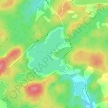
Name: Lac-Poulin topographic map, elevation, terrain.
Average elevation: 338 m
Minimum elevation: 299 m
Maximum elevation: 387 m
Thank you for supporting this site ❤️
Make a donation
Make a donation
Other topographic maps
Click on a map to view its topography, its elevation and its terrain.
Lac du Club de Conservation
Canada > Québec > Beauce-Sartigan > Saint-Côme–Linière
Average elevation: 301 m
Thank you for supporting this site ❤️
Make a donation
Make a donation
Saint-Évariste-de-Forsyth
Canada > Québec > Beauce-Sartigan > Courcelles–Saint-Évariste
Average elevation: 401 m
Thank you for supporting this site ❤️
Make a donation
Make a donation