
Vila de Rei topographic map
Interactive map
Click on the map to display elevation.
About this map
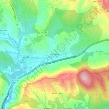
Name: Vila de Rei topographic map, elevation, terrain.
Location: Vila de Rei, Bucelas, Loures, Lisboa, 2670-653, Portugal (38.88254 -9.12504 38.92254 -9.08504)
Average elevation: 174 m
Minimum elevation: 72 m
Maximum elevation: 350 m