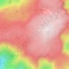
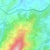
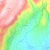
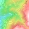
Guarda topographic map
Click on the map to display elevation.
Guarda
Guarda (European Portuguese pronunciation: [ˈɡwaɾðɐ] ) is a city and a municipality in the District of Guarda and the capital of the Beiras e Serra da Estrela sub-region in northern Portugal. The population in 2021 was 40,126, in an area of 712.10 square kilometres (274.94 mi2) with 31,224 inhabitants in the city proper in 2006. Founded by King Sancho I in 1199, Guarda is the city located at the highest altitude in Portugal (1,056 m (3,465 ft) a.s.l.) and one of the most important cities in the Portuguese region of Beira Alta. Serra da Estrela, the highest mountain range in continental Portugal, is partially located in the district. The city is served by national and international trains on the Beira Alta and Baixa railway lines. The present mayor is Sérgio Costa, as an independent. The municipal holiday is November 27.
About this map

Name: Guarda topographic map, elevation, terrain.
Location: Guarda, Portugal (40.38061 -7.46731 40.70096 -7.03274)
Average elevation: 742 m
Minimum elevation: 361 m
Maximum elevation: 1,281 m
Other topographic maps
Click on a map to view its topography, its elevation and its terrain.

Vila Soeiro do Chão
Portugal > Guarda > Juncais, Vila Ruiva e Vila Soeiro do Chão
Average elevation: 439 m

Moinhos D´Aveia
Portugal > Guarda > Alverca da Beira/Bouça Cova > Alverca da Beira
Average elevation: 594 m