Le Poët-en-Percip topographic map
Interactive map
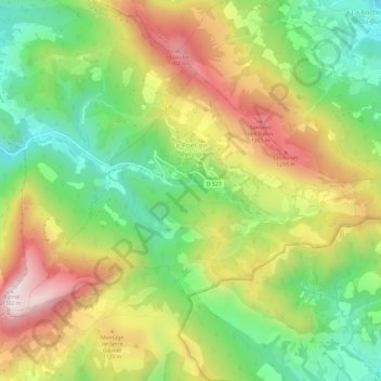
Click on the map to display elevation.
About this map
Name: Le Poët-en-Percip topographic map, elevation, terrain.
Average elevation: 1,003 m
Minimum elevation: 707 m
Maximum elevation: 1,372 m

Click on the map to display elevation.
Name: Le Poët-en-Percip topographic map, elevation, terrain.
Average elevation: 1,003 m
Minimum elevation: 707 m
Maximum elevation: 1,372 m