
Thank you for supporting this site ❤️
Make a donation
Make a donation
South Mutlaa topographic map
Click on the map to display elevation.
Thank you for supporting this site ❤️
Make a donation
Make a donation
About this map
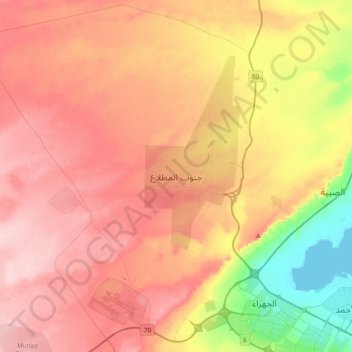
Name: South Mutlaa topographic map, elevation, terrain.
Location: South Mutlaa, Al Metlaa new, Jahra Governorate, Kuwait (29.30261 47.41988 29.62261 47.73988)
Average elevation: 107 m
Minimum elevation: -1 m
Maximum elevation: 187 m
Thank you for supporting this site ❤️
Make a donation
Make a donation
Other topographic maps
Click on a map to view its topography, its elevation and its terrain.