
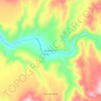
Maitencillo Sur topographic map
Interactive map
Click on the map to display elevation.
About this map
Name: Maitencillo Sur topographic map, elevation, terrain.
Average elevation: 234 m
Minimum elevation: 61 m
Maximum elevation: 400 m
Other topographic maps
Click on a map to view its topography, its elevation and its terrain.
Salala
Chile > Región de Coquimbo > Provincia de Limarí > Ovalle
Salala, Ovalle, Provincia de Limarí, Región de Coquimbo, Chile
Average elevation: 126 m
Chalinga
Chile > Región de Coquimbo > Provincia de Limarí > Ovalle > Chalinga
Chalinga, Ovalle, Provincia de Limarí, Región de Coquimbo, Chile
Average elevation: 167 m