
Make a donation
Hudson River topographic map
Click on the map to display elevation.
Make a donation
Hudson River
The source of the Hudson River is Lake Tear of the Clouds in the Adirondack Park at an elevation of 4,322 feet (1,317 m).[25][26] However, the river is not cartographically called the Hudson River until miles downstream. The river is named Feldspar Brook until its confluence with the Opalescent River, and then is named the Opalescent River until the river reaches Calamity Brook, flowing south from the outlet of Henderson Lake. From that point on, the stream is cartographically known as the Hudson River.[27][28][29] The U.S. Geological Survey (USGS) uses this cartographical definition.[6]
Make a donation
About this map
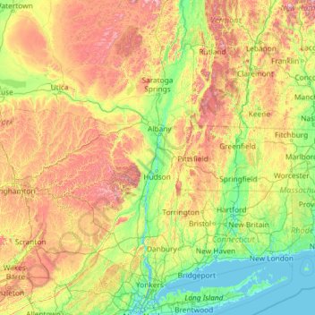
Name: Hudson River topographic map, elevation, terrain.
Location: Hudson River, New York, 12246, United States (40.65258 -74.19894 44.09099 -73.57327)
Average elevation: 297 m
Minimum elevation: -3 m
Maximum elevation: 1,402 m
Make a donation
Other topographic maps
Click on a map to view its topography, its elevation and its terrain.