
Mercerville topographic map
Interactive map
Click on the map to display elevation.
About this map
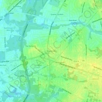
Name: Mercerville topographic map, elevation, terrain.
Average elevation: 24 m
Minimum elevation: 15 m
Maximum elevation: 37 m
Other topographic maps
Click on a map to view its topography, its elevation and its terrain.
The Orchards
United States > New Jersey > Mercer County > Hamilton Township
The Orchards, Hamilton Township, Mercer County, New Jersey, 08619, United States
Average elevation: 22 m
Yardville
United States > New Jersey > Mercer County > Hamilton Township
Yardville, Hamilton Township, Mercer County, New Jersey, 08620, United States
Average elevation: 19 m
Chewalla Park
United States > New Jersey > Mercer County > Hamilton Township > Chewalla Park
Chewalla Park, Hamilton Township, Mercer County, New Jersey, 08619, United States
Average elevation: 21 m
Hamilton Township
United States > New Jersey > Mercer County > Hamilton Township
Hamilton Township, Mercer County, New Jersey, United States
Average elevation: 20 m