
Thank you for supporting this site ❤️
Make a donation
Make a donation
Yuma topographic map
Click on the map to display elevation.
Thank you for supporting this site ❤️
Make a donation
Make a donation
About this map
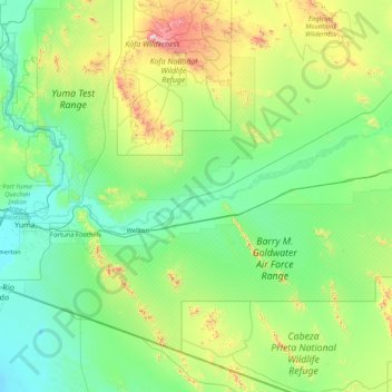
Name: Yuma topographic map, elevation, terrain.
Location: Yuma, Yuma County, Arizona, États-Unis d'Amérique (32.09154 -114.59750 33.49154 -113.19750)
Average elevation: 258 m
Minimum elevation: 26 m
Maximum elevation: 1,420 m
Thank you for supporting this site ❤️
Make a donation
Make a donation
Other topographic maps
Click on a map to view its topography, its elevation and its terrain.