
Greater Accra Region topographic map
Interactive map
Click on the map to display elevation.
About this map
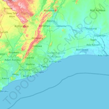
Name: Greater Accra Region topographic map, elevation, terrain.
Location: Greater Accra Region, Ghana (5.47065 -0.51970 6.10761 0.67226)
Average elevation: 62 m
Minimum elevation: -5 m
Maximum elevation: 665 m
Other topographic maps
Click on a map to view its topography, its elevation and its terrain.