
Manhente topographic map
Interactive map
Click on the map to display elevation.
About this map
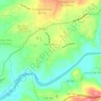
Name: Manhente topographic map, elevation, terrain.
Location: Manhente, Barcelos, Braga, Cávado, Norte, 4750-553, Portugal (41.53643 -8.59040 41.55760 -8.55048)
Average elevation: 40 m
Minimum elevation: 3 m
Maximum elevation: 98 m