
Valayadanda topographic map
Interactive map
Click on the map to display elevation.
About this map
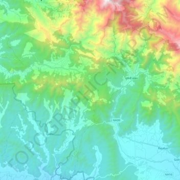
Name: Valayadanda topographic map, elevation, terrain.
Location: Valayadanda, Udayapurgadhi, Udayapur, Province #1, Nepal (26.78198 86.53067 26.98021 86.61526)
Average elevation: 574 m
Minimum elevation: 128 m
Maximum elevation: 2,112 m