
Shindagin Hollow State Forest topographic map
Interactive map
Click on the map to display elevation.
About this map
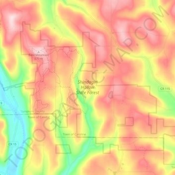
Name: Shindagin Hollow State Forest topographic map, elevation, terrain.
Average elevation: 457 m
Minimum elevation: 286 m
Maximum elevation: 577 m
Other topographic maps
Click on a map to view its topography, its elevation and its terrain.
Caroline Depot
United States > New York > Tompkins County > Town of Caroline
Caroline Depot, Town of Caroline, Tompkins County, New York, 14817, United States
Average elevation: 368 m
Speedsville
United States > New York > Tompkins County > Town of Caroline
Speedsville, Town of Caroline, Tompkins County, New York, United States
Average elevation: 400 m