
Lens topographic map
Interactive map
Click on the map to display elevation.
About this map
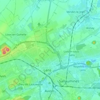
Name: Lens topographic map, elevation, terrain.
Average elevation: 42 m
Minimum elevation: 16 m
Maximum elevation: 170 m
Other topographic maps
Click on a map to view its topography, its elevation and its terrain.
Cité n°9 de Lens
France > Hauts-de-France > Pas-de-Calais > Lens > Cité n°9 de Lens
Cité n°9 de Lens, Lens, Pas-de-Calais, Hauts-de-France, France métropolitaine, 62300, France
Average elevation: 52 m