
Thank you for supporting this site ❤️
Make a donation
Make a donation
Curtincapac topographic map
Click on the map to display elevation.
Thank you for supporting this site ❤️
Make a donation
Make a donation
About this map
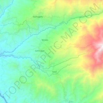
Name: Curtincapac topographic map, elevation, terrain.
Location: Curtincapac, Portovelo, El Oro, Ecuador (-3.75094 -79.59401 -3.71324 -79.48080)
Average elevation: 1,260 m
Minimum elevation: 630 m
Maximum elevation: 2,702 m
Thank you for supporting this site ❤️
Make a donation
Make a donation
Other topographic maps
Click on a map to view its topography, its elevation and its terrain.