
Staffelberg topographic map
Interactive map
Click on the map to display elevation.
About this map
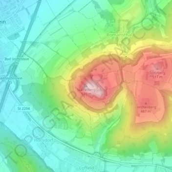
Name: Staffelberg topographic map, elevation, terrain.
Average elevation: 362 m
Minimum elevation: 266 m
Maximum elevation: 532 m
Other topographic maps
Click on a map to view its topography, its elevation and its terrain.
Loffeld
Deutschland > Bayern > Bad Staffelstein > Loffeld
Loffeld, Bad Staffelstein, Landkreis Lichtenfels, Bayern, 96231, Deutschland
Average elevation: 371 m