
Hanret topographic map
Interactive map
Click on the map to display elevation.
About this map
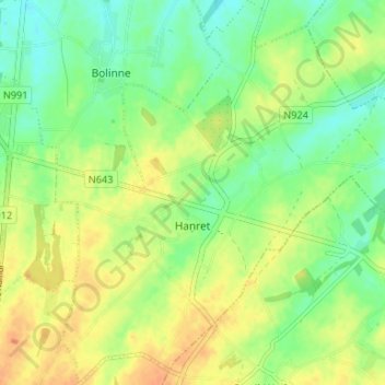
Name: Hanret topographic map, elevation, terrain.
Location: Hanret, Éghezée, Namur, Wallonie, 5310, Belgique (50.56635 4.92039 50.60829 4.98583)
Average elevation: 153 m
Minimum elevation: 136 m
Maximum elevation: 171 m