
Laguna Miramar Peñitas topographic map
Interactive map
Click on the map to display elevation.
About this map
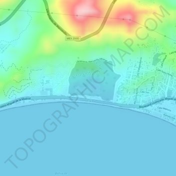
Name: Laguna Miramar Peñitas topographic map, elevation, terrain.
Location: Laguna Miramar Peñitas, Manzanillo, Colima, 28200, México (19.12098 -104.37330 19.12279 -104.36887)
Average elevation: 44 m
Minimum elevation: 0 m
Maximum elevation: 223 m
Other topographic maps
Click on a map to view its topography, its elevation and its terrain.
Playa La Boquita
México > Colima > Manzanillo
Playa La Boquita, Manzanillo, Colima, 28200, México
Average elevation: 19 m