
East Palatka topographic map
Interactive map
Click on the map to display elevation.
About this map
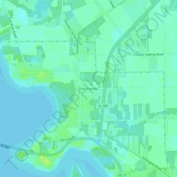
Name: East Palatka topographic map, elevation, terrain.
Location: East Palatka, Putnam County, Florida, 32131, United States (29.63830 -81.61841 29.67830 -81.57841)
Average elevation: 6 m
Minimum elevation: 1 m
Maximum elevation: 17 m
Other topographic maps
Click on a map to view its topography, its elevation and its terrain.
East Palatka
United States > Florida > Putnam County > East Palatka
East Palatka, Putnam County, Florida, United States
Average elevation: 6 m