
Thank you for supporting this site ❤️
Make a donation
Make a donation
Schneeberg topographic map
Click on the map to display elevation.
Thank you for supporting this site ❤️
Make a donation
Make a donation
About this map
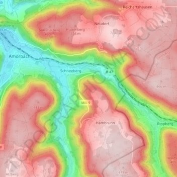
Name: Schneeberg topographic map, elevation, terrain.
Location: Schneeberg, Landkreis Miltenberg, Bayern, 63936, Deutschland (49.60450 9.23245 49.66177 9.29928)
Average elevation: 350 m
Minimum elevation: 152 m
Maximum elevation: 476 m
Thank you for supporting this site ❤️
Make a donation
Make a donation