
Beilsbach topographic map
Interactive map
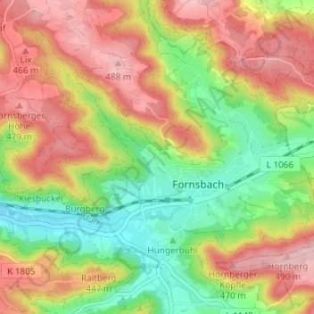
Click on the map to display elevation.
About this map
Name: Beilsbach topographic map, elevation, terrain.
Average elevation: 398 m
Minimum elevation: 301 m
Maximum elevation: 498 m
Other topographic maps
Click on a map to view its topography, its elevation and its terrain.
Kirchenkirnberg
Deutschland > Baden-Württemberg > Rems-Murr-Kreis > Murrhardt
Kirchenkirnberg, Murrhardt, Rems-Murr-Kreis, Baden-Württemberg, 74427, Deutschland
Average elevation: 480 m
Murrhardt
Deutschland > Baden-Württemberg > Rems-Murr-Kreis > Murrhardt
Murrhardt, Rems-Murr-Kreis, Baden-Württemberg, 71540, Deutschland
Average elevation: 428 m