
Ocqueoc Township topographic map
Interactive map
Click on the map to display elevation.
About this map
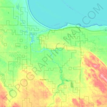
Name: Ocqueoc Township topographic map, elevation, terrain.
Average elevation: 210 m
Minimum elevation: 171 m
Maximum elevation: 287 m
Other topographic maps
Click on a map to view its topography, its elevation and its terrain.
Calcite
United States > Michigan > Presque Isle County > Rogers City
Calcite, Rogers City, Presque Isle County, Michigan, 49779, United States
Average elevation: 186 m
Orchard Point
United States > Michigan > Presque Isle County > Presque Isle Township
Orchard Point, Presque Isle Township, Presque Isle County, Michigan, United States
Average elevation: 198 m