
Thank you for supporting this site ❤️
Make a donation
Make a donation
Poolville topographic map
Click on the map to display elevation.
Thank you for supporting this site ❤️
Make a donation
Make a donation
About this map
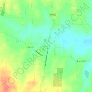
Name: Poolville topographic map, elevation, terrain.
Location: Poolville, Parker County, Texas, 76487, United States (32.95363 -97.87959 32.99363 -97.83959)
Average elevation: 358 m
Minimum elevation: 334 m
Maximum elevation: 393 m
Thank you for supporting this site ❤️
Make a donation
Make a donation
Other topographic maps
Click on a map to view its topography, its elevation and its terrain.
Thank you for supporting this site ❤️
Make a donation
Make a donation
Thank you for supporting this site ❤️
Make a donation
Make a donation