
Forest Hills topographic map
Interactive map
Click on the map to display elevation.
About this map
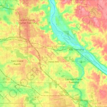
Name: Forest Hills topographic map, elevation, terrain.
Average elevation: 229 m
Minimum elevation: 181 m
Maximum elevation: 274 m
Other topographic maps
Click on a map to view its topography, its elevation and its terrain.
Ada
United States > Michigan > Kent County > Ada Township
Ada, Ada Township, Kent County, Michigan, 49355, United States
Average elevation: 208 m