
坪地彝族乡 topographic map
Interactive map
Click on the map to display elevation.
About this map
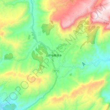
Name: 坪地彝族乡 topographic map, elevation, terrain.
Location: 坪地彝族乡, 六盘水市, 贵州省, 中国 (26.06947 104.55891 26.14947 104.63891)
Average elevation: 2,205 m
Minimum elevation: 1,792 m
Maximum elevation: 2,847 m
Other topographic maps
Click on a map to view its topography, its elevation and its terrain.