Geolocate

生米村 topographic map

Interactive map

Click on the map to display elevation.

About this map

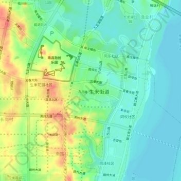
Name: 生米村 topographic map, elevation, terrain.

Location: 生米村, 红谷滩区, 南昌市, 江西省, 中国 (28.55354 115.77061 28.59354 115.81061)

Average elevation: 31 m

Minimum elevation: 11 m

Maximum elevation: 69 m

Other topographic maps

Click on a map to view its topography, its elevation and its terrain.

山图村

中国 > 江西省 > 红谷滩区

山图村, 红谷滩区, 南昌市, 江西省, 中国

Average elevation: 44 m

北坊

中国 > 江西省 > 红谷滩区 > 厚田乡

北坊, 厚田乡, 红谷滩区, 南昌市, 江西省, 中国

Average elevation: 28 m

长桶村

中国 > 江西省 > 红谷滩区

长桶村, 红谷滩区, 南昌市, 江西省, 330063, 中国

Average elevation: 30 m

雅瑶村

中国 > 江西省 > 红谷滩区 > 渔业村

雅瑶村, 九龙湖街道, 渔业村, 红谷滩区, 南昌市, 江西省, 中国

Average elevation: 22 m

岭口村

中国 > 江西省 > 红谷滩区

岭口村, 红谷滩区, 南昌市, 江西省, 330038, 中国

Average elevation: 21 m

卫东街道

中国 > 江西省 > 红谷滩区 > 渔业村

卫东街道, 渔业村, 红谷滩区, 南昌市, 江西省, 中国

Average elevation: 22 m