
Thank you for supporting this site ❤️
Make a donation
Make a donation
Kodumbu topographic map
Click on the map to display elevation.
Thank you for supporting this site ❤️
Make a donation
Make a donation
About this map
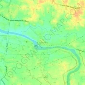
Name: Kodumbu topographic map, elevation, terrain.
Location: Kodumbu, Palakkad, Palakkad District, Kerala, 678551, India (10.72265 76.67440 10.76265 76.71440)
Average elevation: 95 m
Minimum elevation: 76 m
Maximum elevation: 115 m
Thank you for supporting this site ❤️
Make a donation
Make a donation
Other topographic maps
Click on a map to view its topography, its elevation and its terrain.