
Hocquincourt topographic map
Interactive map
Click on the map to display elevation.
About this map
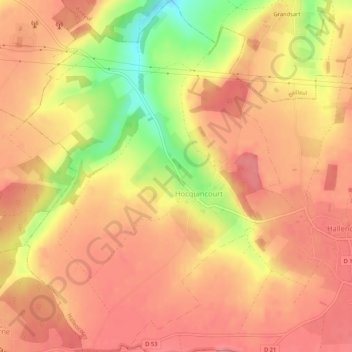
Name: Hocquincourt topographic map, elevation, terrain.
Average elevation: 98 m
Minimum elevation: 36 m
Maximum elevation: 125 m
Other topographic maps
Click on a map to view its topography, its elevation and its terrain.
Wanel
France > Hauts-de-France > Somme > Hallencourt
Wanel, Hallencourt, Abbeville, Somme, Hauts-de-France, France métropolitaine, 80490, France
Average elevation: 87 m