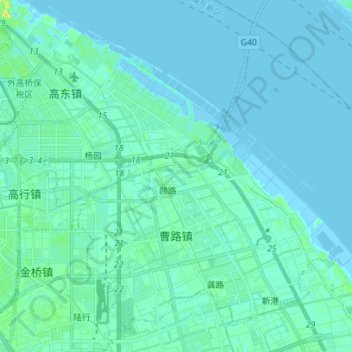
Geolocate

曹路镇 topographic map

Interactive map

Click on the map to display elevation.

About this map

Name: 曹路镇 topographic map, elevation, terrain.

Location: 曹路镇, 浦东新区, 上海市, 中国 (31.24814 121.62262 31.35301 121.76255)

Average elevation: 3 m

Minimum elevation: -2 m

Maximum elevation: 20 m

Other topographic maps

Click on a map to view its topography, its elevation and its terrain.

高东镇

中国 > 上海市 > 浦东新区

高东镇, 浦东新区, 上海市, 中国

Average elevation: 3 m

高桥镇

中国 > 上海市 > 浦东新区

高桥镇, 浦东新区, 上海市, 200137, 中国

Average elevation: 2 m

康桥镇

中国 > 上海市 > 浦东新区

康桥镇, 浦东新区, 上海市, 201315, 中国

Average elevation: 4 m

祝桥镇

中国 > 上海市 > 浦东新区

祝桥镇, 浦东新区, 上海市, 中国

Average elevation: 3 m

南汇新城镇

中国 > 上海市 > 浦东新区

南汇新城镇, 浦东新区, 上海市, 中国

Average elevation: 1 m

张江镇

中国 > 上海市 > 浦东新区

张江镇, 浦东新区, 上海市, 中国

Average elevation: 4 m

黄浦江

中国 > 上海市 > 浦东新区

黄浦江, 浦明路, 洋泾街道, 浦东新区, 上海市, 200007, 中国

Average elevation: 8 m